| Applies To |
|
| Product(s): |
WaterGEMS, SewerGEMS, HAMMER |
| Version(s): |
CONNECT Edition, V8i |
| Environment: |
ArcGIS Pro, ArcMap |
| Area: |
Modeling |
| Original Author: |
Mark Pachlhofer, Bentley Technical Support Group |
Problem
What is a Geotable?
Solution
A GeoTable is a special type of Flextable that determines which fields (attributes) are included in the WaterGEMS, SewerGEMS or HAMMER geodatabase when working inside the ArcGIS Pro or ArcMap platform. ArcMap and ArcGIS Pro interact directly with an intermediate personal geodatabase (MDB file or GDB file) associated with the hydraulic model, not the hydraulic model database (wtg.sqlite or .stsw.sqlite). The fields selected in the GeoTable are the fields linked between the hydraulic model database and the geodatabase. ArcMap can then apply symbology effects from the available geotable fields.
In short, you add fields to the Geotable that you want to be able to color code or annotate on while in ArcMap integrated mode.
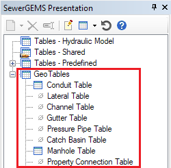
The GeoTables have their own separate section in the Flextable manager:
Ensure that you have admin/write permissions in your ArcMap or ArcGIS Pro session, otherwise any new fields that you have added to the Geotables may not be saved, and so the color coding you define will no longer work in your next ArcMap session. Alternatively you can start a new model in the Standalone version, configure your Geotables, close Standalone (which should save the changes), and then re-open the model in the ArcMap or ArcGIS Pro integrated version.
See Also
WaterGEMS for ArcGIS Pro and WaterGEMS for ArcMap FAQs
SewerGEMS for ArcGIS Pro and SewerGEMS for ArcMap FAQs
How to color code elements in ArcMap or ArcGIS Pro integrated mode