| Product(s): |
SewerGEMS, CivilStorm, SewerCAD, StormCAD, SUDA, OpenRoads Designer |
| Version(s): |
V8i, CONNECT Edition |
| Area: |
Layout and data input |
Problem
Why is scaled pipe length measured differently in Bentley's Civil products (ex: OpenRoads Designer) compared to the OpenFlows products? (ex: StormCAD)
Solution
When the hydraulic calculations are considered the length is measured from center to center, whereas when you are measuring the length with OpenRoads Designer, the length measured is face-to-face length.
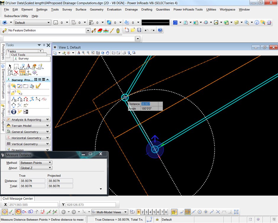
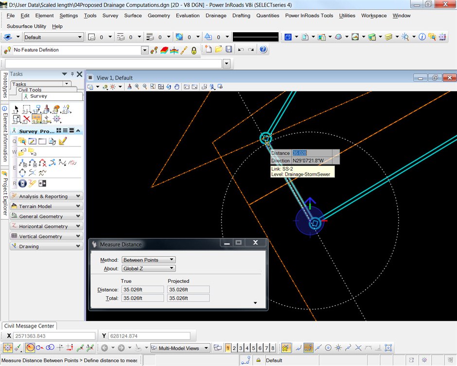
Here is the look at the length measured for hydraulic calculations and using Subsurface Utilities (V8i SELECTseries 4 but the same concept applies to OpenRoads Designer) ; i.e., lengths measured center to center and face to face.
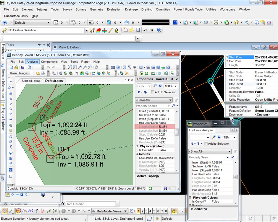
Even if you are importing the project between Subsurface Utilities and OpenFlows products, the length remains the same making no difference in the hydraulic lengths. (See the screenshot below). It shows that the center-to-center length is considered for hydraulic calculations and the Subsurface Utilities product as well. This means even if you are moving the project between these products, there will be no change in the results as center to center length is considered in both the products.
In contrast, face-to-face length measured in Subsurface Utilities is considered while building the cells and 3D models.
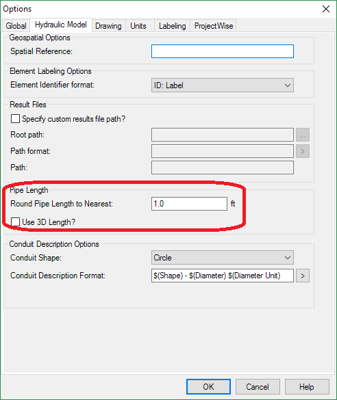
Note that you may also see small differences in the center-to-center length due to the rounding option available in the OpenFlows product. In the hydraulic model Options dialog (Tools > Options > Project for the OpenFlows products or Subsurface Utilties> Project> Project Defaults> 'Project Tab' for V8i SS4 of the Civil products) you will see an option to "Round pipe lengths to the nearest:", which will round the length values used in the profiles. There is also a check box to calculate pipe lengths using node elevations. This is referred to as "3D" length, because it accounts for the difference in elevation between end nodes, as opposed to a bird's eye view.
See Also
Center-to-center vs wall-to-wall length and slope calculations