| Product(s): |
SewerGEMS, CivilStorm |
|
| Version(s): |
CONNECT Edition, V8i (08.11.05.58+) |
|
| Area: |
Calculations |
|
Problem
How do I interpret the results when using the surface storage option in a manhole or catch basin, to check if surface storage is occurring and working properly with overflow?
What does it mean when a positive value is seen for the "overflow" result field of a node that uses the surface storage option?

Solution
When the "Surface Storage Type" is set to "Default Storage Equation", "Ponded Area" or "Surface Depth-Area Curve", this models additional storage above the top of the node. For example it can be used to assess depth of flooding in a parking lot about a grate inlet in sag.
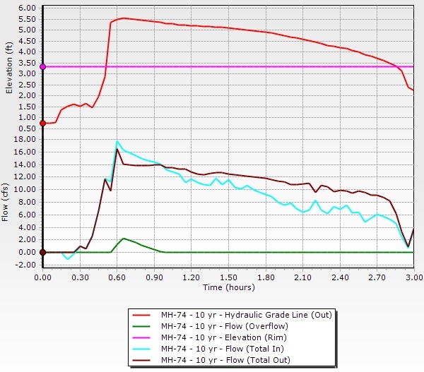
When using the surface storage option, when the HGL at the node rises above the rim elevation (from subsurface flooding), flow will start to "spill" into the surface storage and the HGL will be allowed to rise further. You can either graph the "Depth (Flooding)" result or graph Hydraulic Grade In and Rim elevation together with the "Flow (Total In)" and "Flow (Total Out)" result to visualize this.
Note: Starting with SewerGEMS and CivilStorm version 10.04.00.158, 2D Modeling is included with the product. This introduces another method to analyze flooding in a 1D/2D system. See this wiki for more information: 2D Modeling in SewerGEMS and CivilStorm.
A General Note on Assessing Where Flooding Occurs
Using surface storage is appropriate for cases where water ponds above the manhole or inlet and can later recede back into the subsurface system. Depending on the numerical solver and other configuration of the node, you may or may not be able to use the overflowing results fields to assess if a flooding condition occurs when using surface storage (since in some situations it is not considered as overflow since it is not lost to the system).
If you are wanting to identify cases where the HGL exceeds the rim elevation regardless of whether that overflow gets stored in surface storage, passes down a gutter or is lost, then you could use the "Depth (Flooding)" attribute (greater than zero indicating flooding conditions occur) or if you are using the SWMM solver (currently does not support the "Depth (flooding)" attribute as seen here) or want to see if this ever happens during the whole simulation (since the "Depth (flooding)" depends on the current timestep), you could create a formula-derived user data extension based on the rim elevation and max HGL. The below example uses the iif function to check for negative values and show them as zero.
iif( [StandardStatistics_MaximumHGL;Meters] - [Physical_RimElevation;Meters] < 0, 0, [StandardStatistics_MaximumHGL;Meters] - [Physical_RimElevation;Meters] )
Default Storage Equation and Surface Depth-Area Curve
When using the Default Storage Equation or Surface Depth-Area Curve, you may see a positive value shown in the "Flow (Overflow)" result field. This overflow is lost from the system and indicates that the surface storage top has been exceeded. For the Surface Depth-Area Curve, this happens when the flooding depth exceeds the maximum depth in the curve. For the Default Storage Equation, this occurs at a flooding depth above the value entered for the "Maximum Gutter Depth" (previously this was hard-coded as 2.0 ft, and then earlier to 0.4 ft which you may see mentioned in the Help Documentation)
Note that the default storage equation uses the following formula to internally calculate a reasonable surface storage. Depth and area units are converted automatically based on your current display units.
- When depth (above ground) is less than 4.0 feet: Area (acres) = 0.262 y - 0.068 y^2 + 0.006 y^3 (where y = depth in feet)
- When depth (above ground) is greater than 4.0 feet: Area = 0.344 acres
Ponded Area
For the Ponded Area option, since a constant surface area is assumed, no overflow will occur at any depth. With this surface storage type, positive values for "Flow (Overflow)" indicate subsurface flooding flow that exits the rim elevation and enters the ponded area. This volume is not lost and can later recede back into the catch basin.
When modeling an in-sag inlet with the Ponded Area surface storage type, if no downstream gutter is connected, subsurface overflow will pool up above the inlet in the ponded area, until the depth exceeds the "maximum gutter depth" property, beyond which overflow (lost from the system) will occur.
Note: Currently (as of version 10.00.00.45), only the "Ponded Area" surface storage type is supported by the Explicit (SWMM) numerical solver. You will see a user notification about this if you are using the SWMM solver with one of the other Surface Storage types.
Inlet Type Considerations when In-Sag
As of July, 2020 (version 10.03.01.08), when using one of the surface storage options along with "in sag" as the inlet location, catalog inlets are not supported. In this situation you must select a different inlet type such as Full Capture, or the results may not be valid (you may see overflow occur instead of the ponded area being used).
Gutter Flow Considerations
If you have a downstream gutter attached to the catch basin (or channel with invert set to the catch basin rim), it will receive flow as soon as subsurface flooding causes the hydraulic grade to rise above the rim elevation. Regular surface runoff will be captured as normal (and if in-sag, 100% of surface runoff will be captured by the inlet as long as the inlet is not flooded)
Backwater Conditions
If a storm-sewer system is completely backwater controlled, the Implicit and Explicit solvers will report the hydraulic grade required in order to balance out the energy equations. This may result in a flooding depth that does not appear to change, even if the ponded area above the structure is changed. One way to visualize this backwater impact would be to look at a profile back to the manhole in question.
In the profile, you can see that if the hydraulic grade was lower (because of a larger ponded area), that water would be flowing toward a higher hydraulic grade (essentially flowing "uphill"). Essentially, if the hydraulic grade or flooding depth was lower, the energy equations would no longer balance and the results would not be valid. In a system with less flow and where there is no backwater control, the ponded area size will make a difference in the results.
See Also
Modeling surface ponding for overflow above multiple inlets